- RESEARCH & VISUALIZATION
- URBAN MORPHOLOGY | BUILT ENVIRONMENT | GEOGRAPHY
- Okabe Lab | Department of Architecture | The University of Tokyo
Human cities in the eyes of extraterrestrial beings
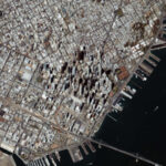
A city built by a group of humans, a nest mound built by a termite colony, a coral reef formed by reef-building corals—from an extraterrestrial perspective, these vastly different structures may seem identical. Cities and termite nest mounds are built without the builder ever fully grasping the entire structure. Cities and coral reefs are robust, calcium-based structures that protect the organisms that inhabit them from the environment. A nest mound for a termite colony and a coral reef for a coral polyp both function as life-support systems to ensure the survival and reproduction of the residents. From the perspective that humans, termites and corals are all similar reproductive organisms on the planet, it might be possible to view the human cities as collective exoskeletons that ensure the survival and reproduction of the human species.
This study focused on the patterns and textures formed by the protrusions on the surface of collective exoskeletons (i.e., buildings for humans), and explored the potential causal effects of geographical conditions on the morphology.

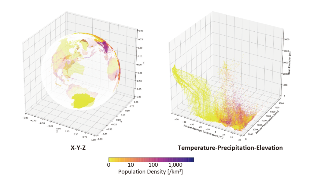
Multivariate globe
The appearance of the world map—the surface of planet Earth as we recognize it—is primarily an illustration of the spatial distribution of a binary variable—land/water distinction. Once we switch to illustrating the spatial distribution of other variables—elevation, population, temperature, precipitation, etc.—the map would take on a completely new look, which would still be unmistakably a “world map.”
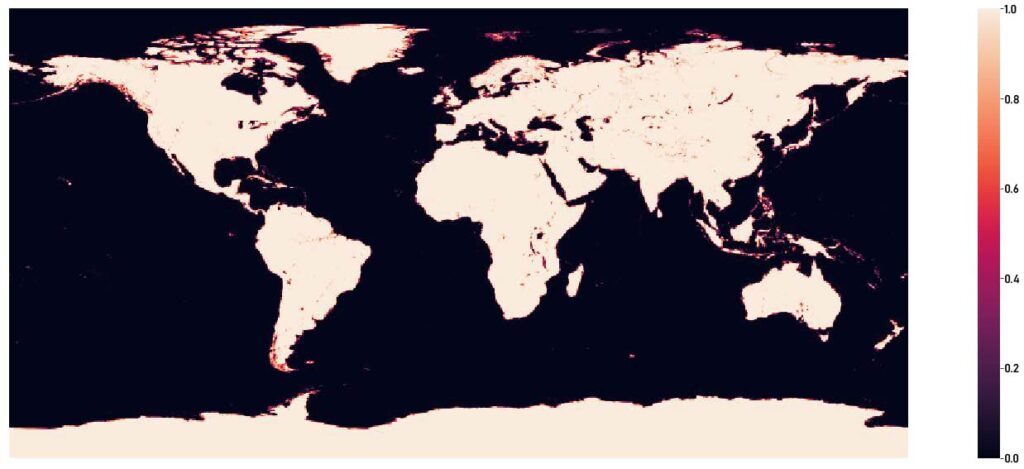


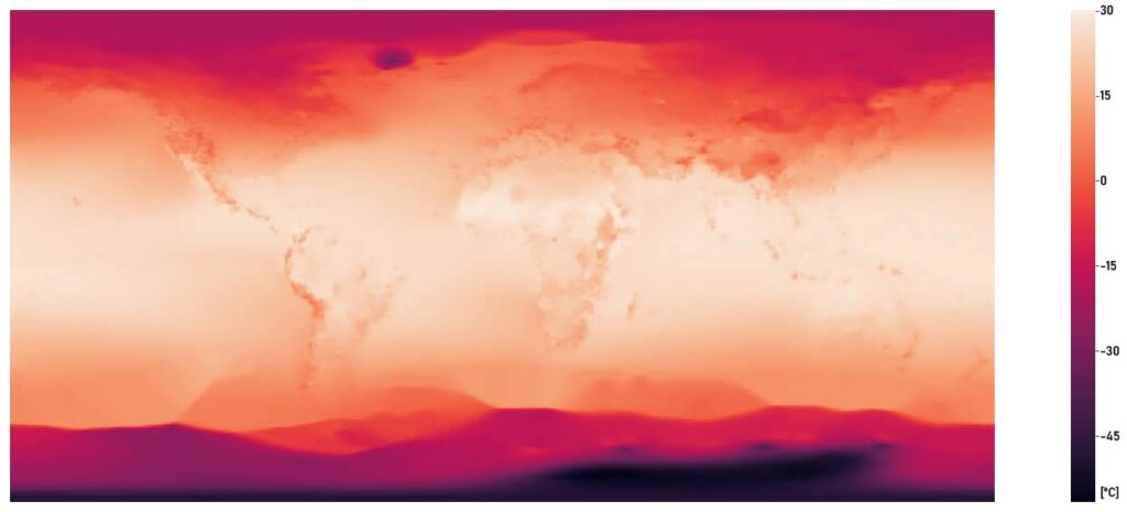
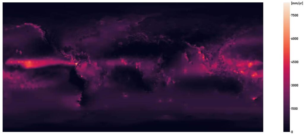
The spheric Earth as we know would morph into a drastically different shape as we remap the 0.5-degree meshes of the globe into a space of different variables—temperature, precipitation & elevation—instead of their coordination in the physical 3-D space.
Related Publications
- Igarashi, T. (Mar 2017) “A study on the cause of texture expression on joint-exoskeletons of Homo sapiens [Japanese] (ホモ・サピエンスの共有外骨格におけるテクスチャの発現に関する研究),” Bachelor’s thesis, Department of Architecture, the University of Tokyo.
- HEADER IMAGE | NASA